Drumlins
January 16, 2019Michigan is a state shaped by glaciers. During the last glacial retreat called the “Wisconsin glaciation” approximately 10,000 years ago, the ice (and its meltwaters) played a big role in shaping the landscapes we see today.
When the ice was completely gone (about 4,000 years ago) many landforms including moraines, kettle lakes, outwash plains and perched sand dunes were left behind and can be seen across the region. They are especially noticeable in winter when views are more expansive.
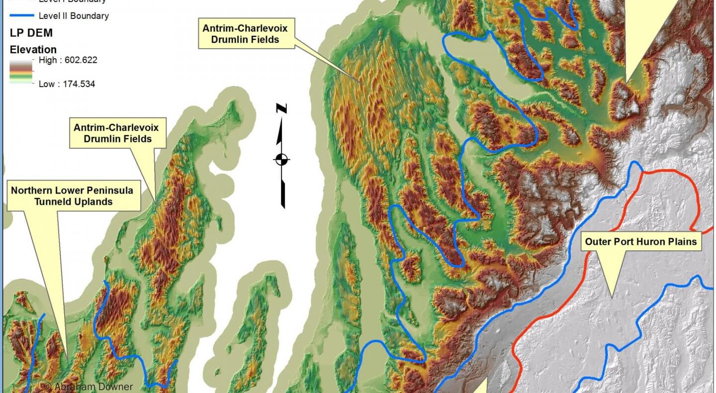
Another, perhaps lesser known glacial landform, are drumlins. Our region has one of the largest drumlin “fields” (collection of drumlins) in the entire midwest. The field includes northern Antrim County and Charlevoix County and extends to Leelanau County and Old Mission Peninsula. Defining a drumlin is a complicated matter but simplistically, they are low, tear-drop shaped hills created in a series from sediments left behind as glaciers retreat. Today they are visible from aerial photos and easily felt by anyone driving on roads perpendicular to the small hills (think rollercoaster!). Drumlins usually have a blunt nose pointing in the direction from which the ice approached, and a gentler slope tapering in the other direction. So, in our region the glacier approached from the northwest.
Some form of glacial activity can be seen at all of our nature preserves. This includes everything from the kettle lakes at Upper Manistee Headwaters Preserve to the large ridge at Maple Bay which is a remnant from the retreat of a glacial lake. This diversity of land types contributes to the biological diversity and beauty of our region.
Enjoy!
(Map created by Abraham Downer)
Categorised in: Field Notes