


Protected, owned and managed by the Grand Traverse Regional Land Conservancy.
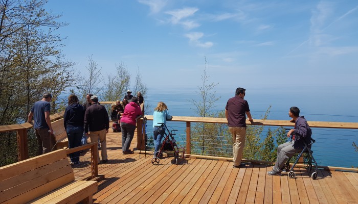
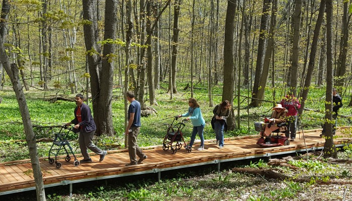
Please read our Mobility Device Use Policy for this trail, which can be accessed from the Baldy parking lot (see map below left).
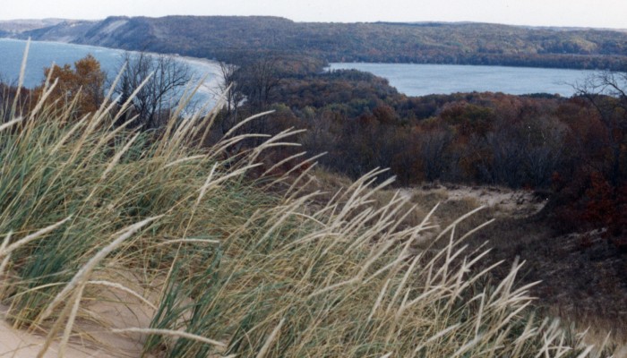
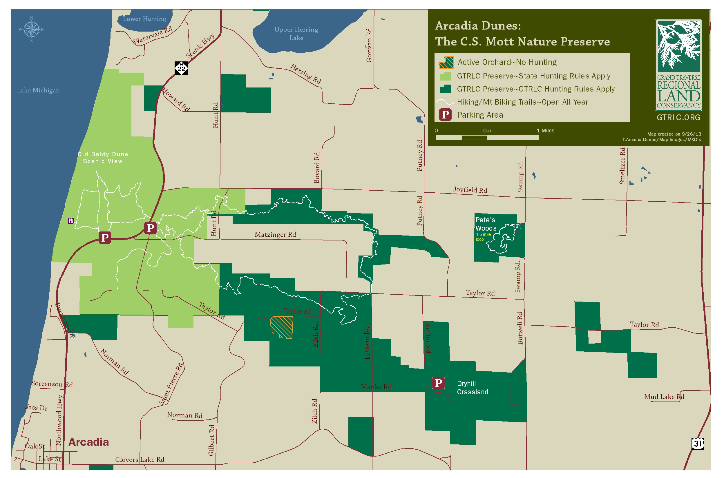
Arcadia Dunes, GTRLC’s largest preserve, includes over 15 miles of trail that wind through dunes, forests and many other landscapes. Adjacent working farms have also been permanently protected, ensuring the longevity of this area’s rich agricultural heritage. This incredibly diverse preserve provides a wide range of recreation opportunities and experiences, from hiking to birding to mountain biking and hunting.
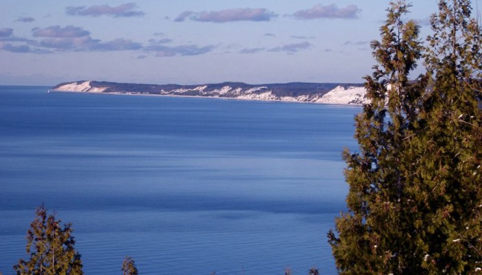
This preserve is home to the very popular Overlook Trail at Arcadia Dunes, a universally accessible trail that leaves from the Baldy parking lot and takes users to a stunning overlook of Lake Michigan. Be sure to visit this special trail throughout the year for different – but equally dazzling – experiences.
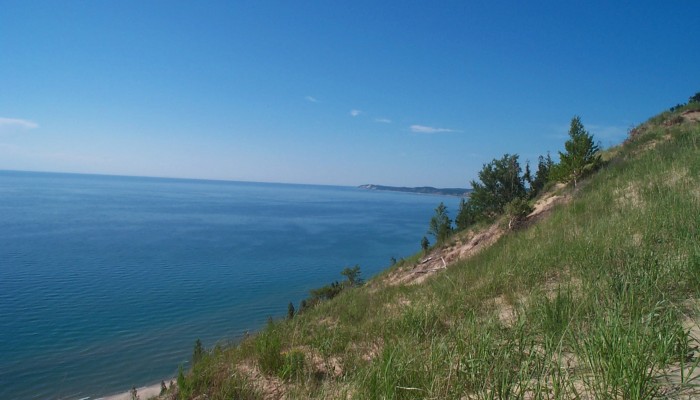
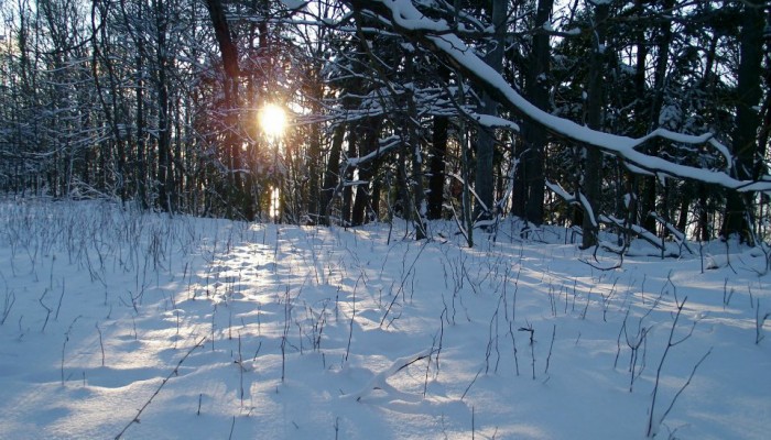
The multi-use Dry Hill Trails are widely known for fantastic hiking, trail running and mountain biking. The Camp Trail is another multi-use trail built on relatively flat ground, making it a wonderful hike or beginner mountain bike ride. Pete’s Woods is a wonderful little hike with an unparalleled wildflower display in the spring. The Baldy Trails wander through beautiful forests and include breathtaking views of Lake Michigan from dunes high above the water. The Spring Woodland Wild Flowers Guide & Dune Wildflowers Guide will help you identify what you see along the trail. (We also have a very detailed guide available for just Pete’s Woods, though many of those species can be seen elsewhere.)
Arcadia Dunes, part of the Sleeping Bear Birding Trail, is also an amazing birding experience. To learn more about birding at Arcadia Dunes, read the Sleeping Bear Birding Trail‘s great birding site descriptions.
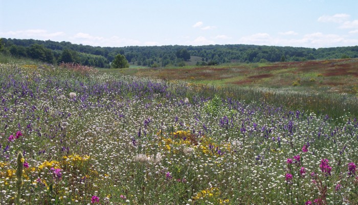
One of Arcadia Dune’s birding sites is the Dryhill Grassland. Grasslands are immensely diverse and beautiful ecosystems, but they have nearly disappeared in recent decades. Check out the Grassland Birds of Arcadia Dunes Guide to learn which birds make the Grassland their home. Experiencing the unique wide-open beauty of this landscape is worth the trip, whether you are a birder or not.
Read about the protection of Arcadia Dunes in the Coastal Campaign chapter from our 25th-anniversary publication, Love the Land: Pass it On.
For the story of the new universal access trail here, read the the Overlook Trail chapter from our Campaign for Generations publication.